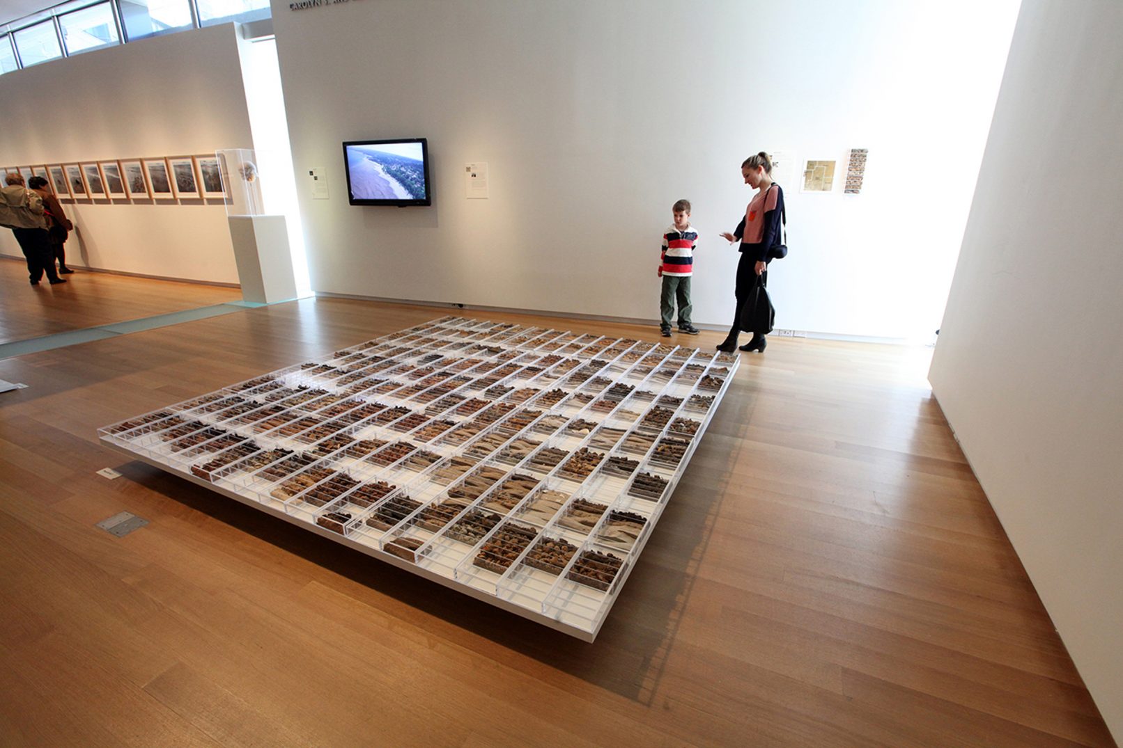
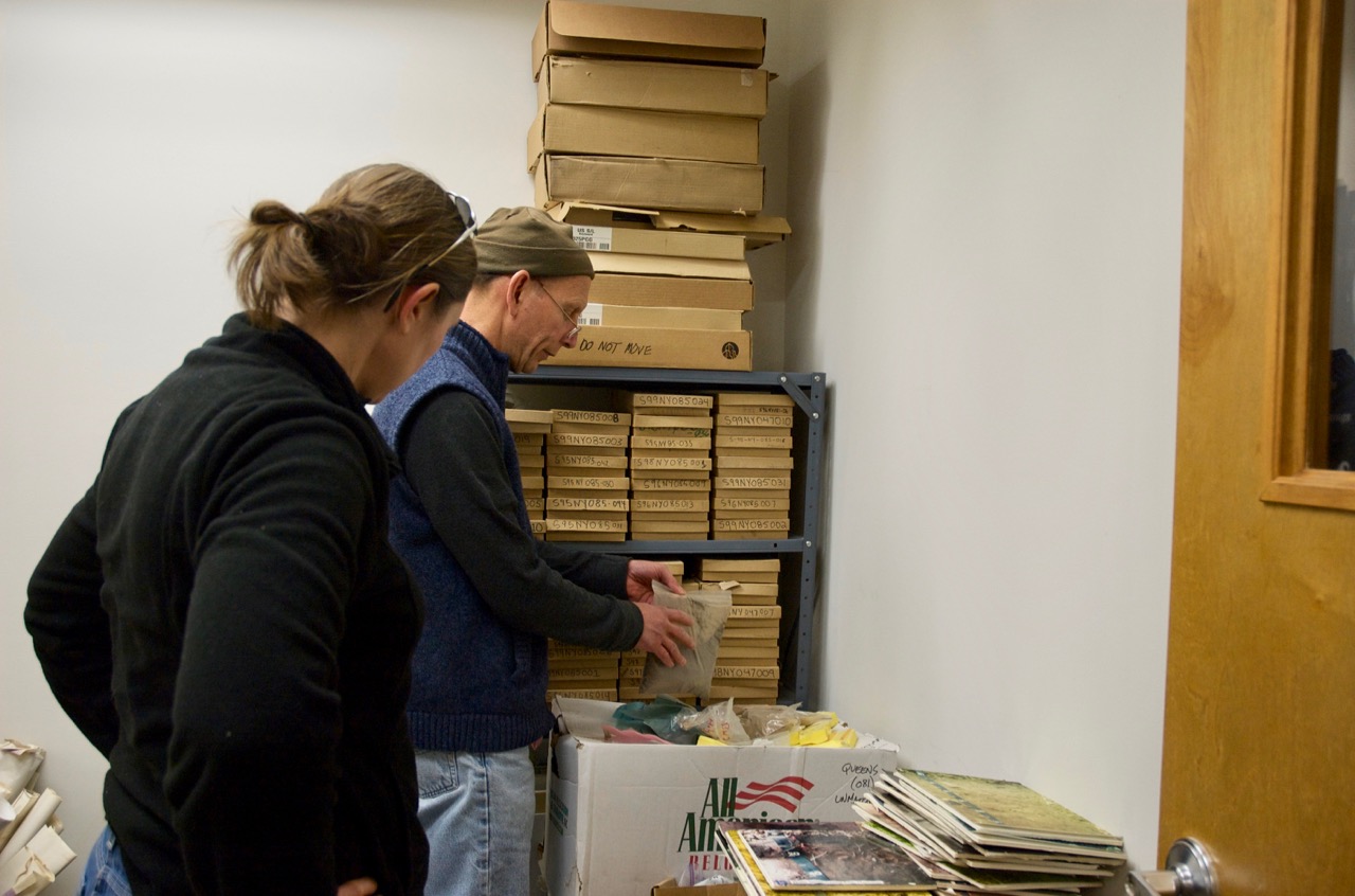
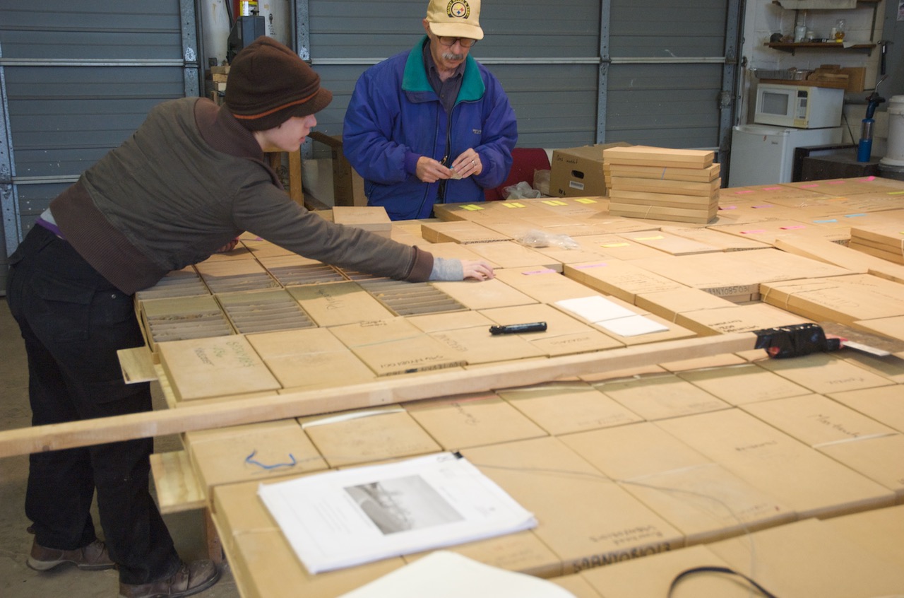
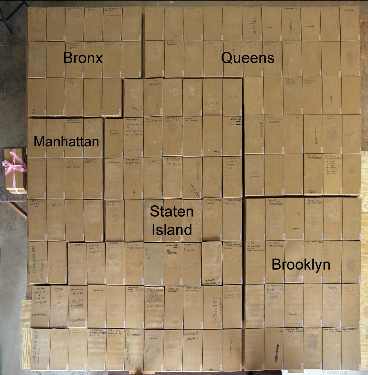
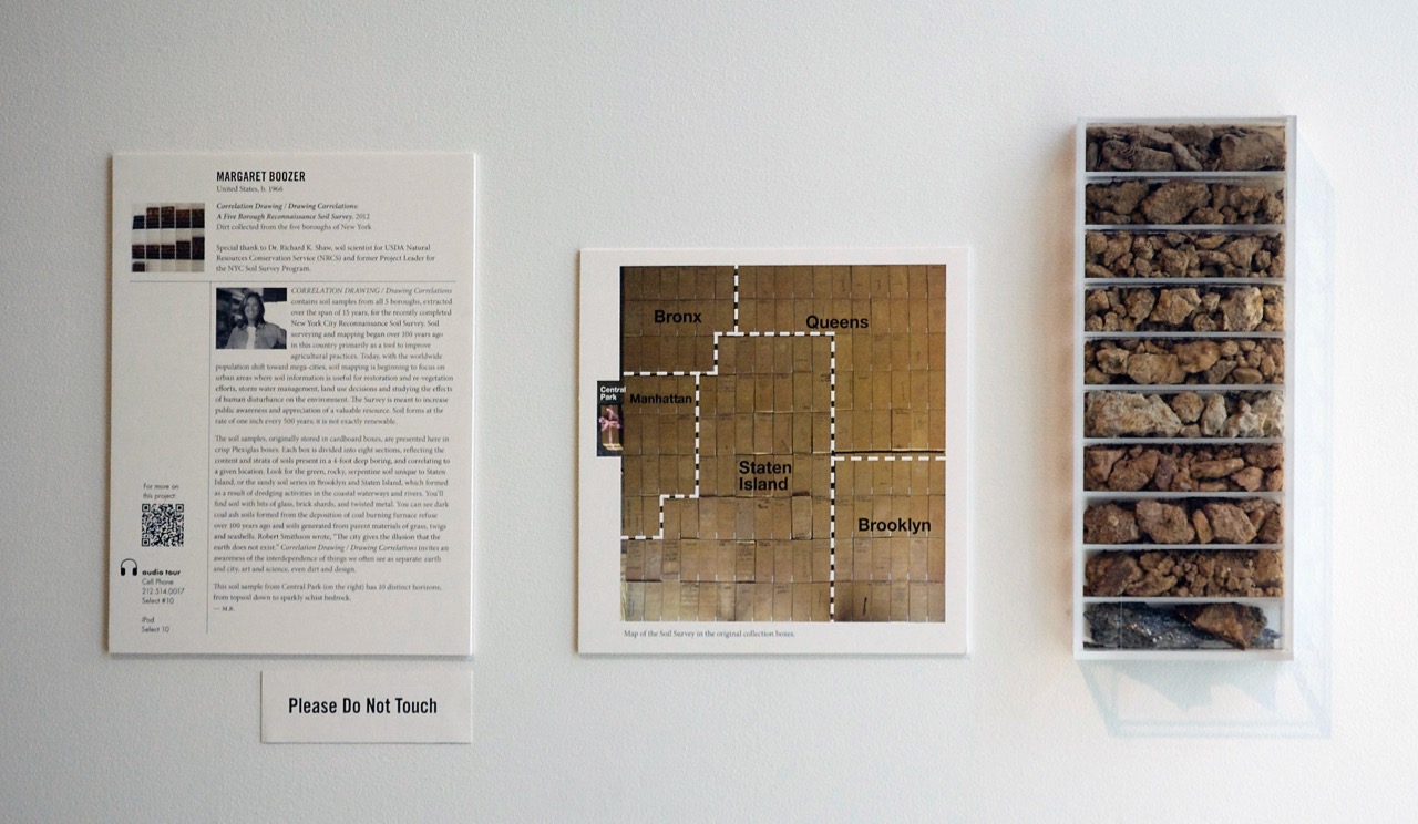
Correlation Drawing/ Drawing Correlations contains soil samples from all 5 boroughs, extracted over the span of 15 years, for the recently completed New York City Reconnaissance Soil Survey. The soils came to me from Dr. Richard K. Shaw, soil scientist for Natural Resources Conservation Service (NRCS) and former Project Leader for the NYC Soil Survey Program, who graciously agreed to collaborate with me on this project.
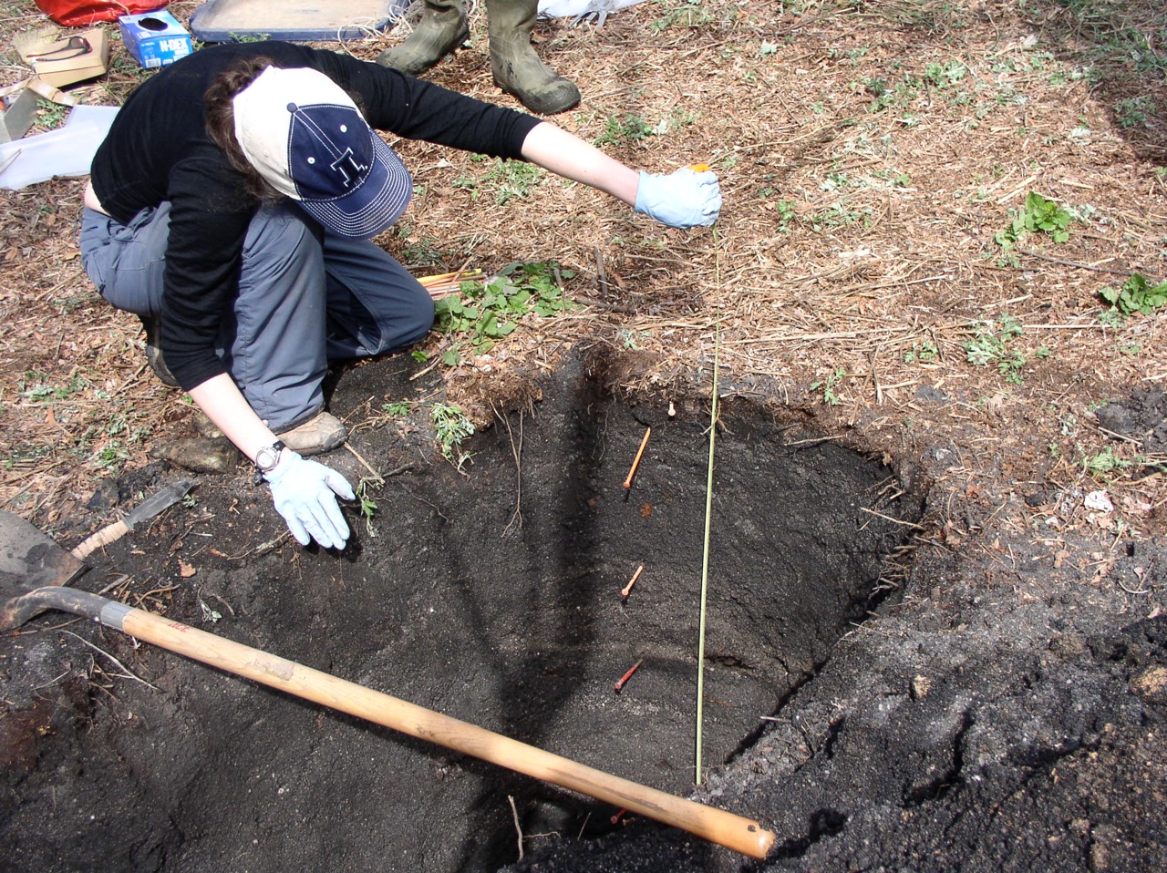
Soil surveying and mapping began over 100 years ago in this country primarily as a tool to improve agricultural practices. Today, with the worldwide population shift toward mega-cities, soil mapping is beginning to focus on urban areas as well where soils information is useful for restoration and re-vegetation efforts, storm water management, land use decisions and most importantly, studying the effects of human disturbance on the environment. The Survey as a document is meant to increase public awareness and appreciation of a valuable resource. Soil forms at the rate of one inch every 500 years. It’s not exactly renewable.
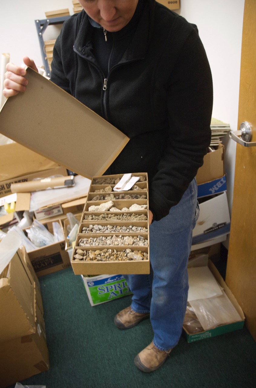
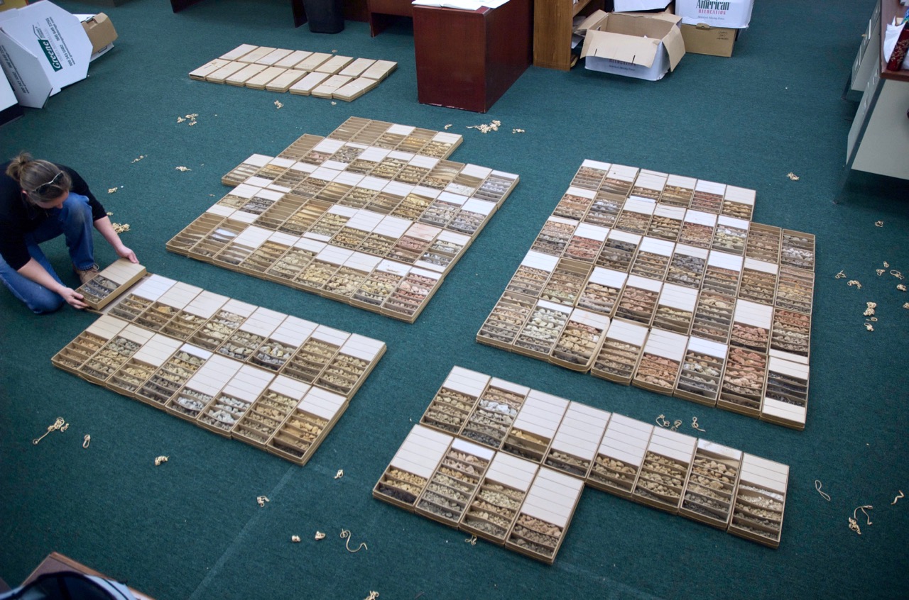
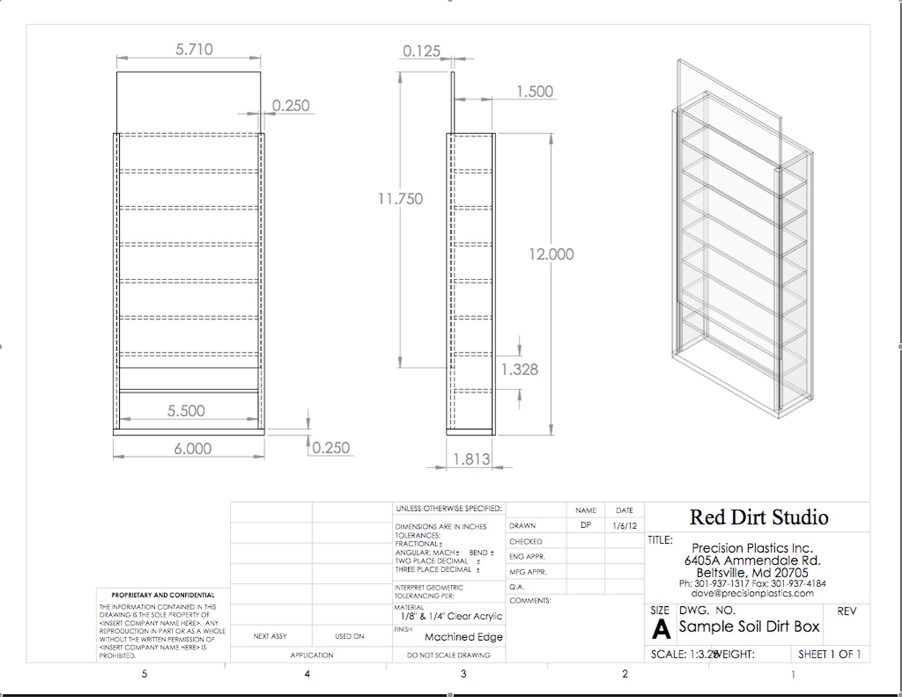
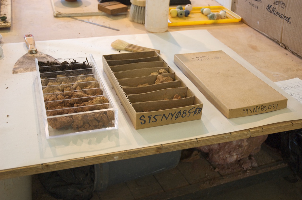
The soil samples are presented here in crisp Plexiglas translations of their original cardboard boxes. Each box is divided into eight sections, reflecting the content and strata of soils present in a 4-foot deep boring, and correlating to a given location. Correlation boxes, as they are called, are simple and functional tools for collecting in the field and transporting back to the office and lab. Translated into Plexiglas, they are also tools to expose the beauty, variety and complexity of the earth they contain.
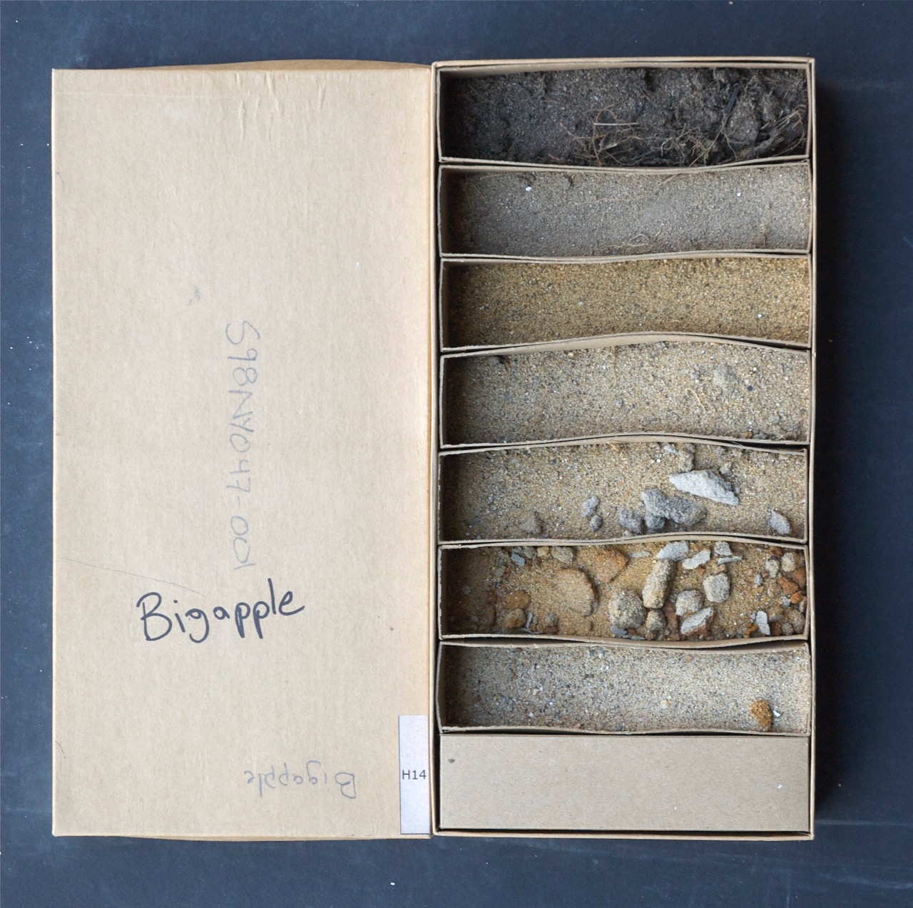
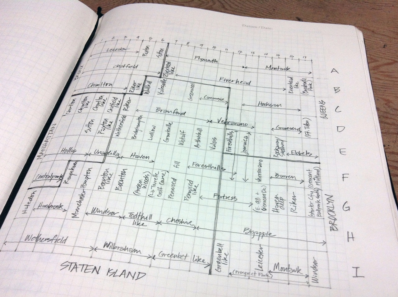
Look for the green, rocky, serpentine soil unique to Staten Island and sparkly schist bedrock from Central park. You can see descending layers of soils generated from parent materials of grass, twigs and seashells. There is a sandy soil series in Brooklyn and Staten Island (row H, columns 11-17), called Bigapple, which formed as a result of dredging activities in the coastal waterways and rivers. It is but one of many new anthropogenic soils that were identified named through this Survey. You can see dark coal ash soils formed from the deposition of coal burning furnace refuse over 100 years ago. You’ll find soils with bits of glass, brick shards, and twisted metal. Even the detritus is beautiful in a correlation box.
Robert Smithson wrote, “The city gives the illusion that the earth does not exist.” Correlation Drawing/ Drawing Correlations invites an awareness of the interdependence of things we often see as separate: earth and city, art and science, even dirt and design.
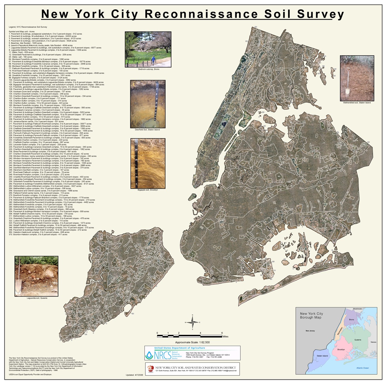
More information on the New York City Reconnaissance Soil Survey can be found here (NYC Survey) and here (NRCS).